

There is one problem with rivers, they are prone to flooding..
And so, the Fleet Storm Relief Sewer was built in the 1875 in order to give extra capacity to the Fleet Sewer.
In 1317 a long drought was broken by an enormous thunderstorm.
The resulting flood caused serious damage to both Holborn and Fleet bridges in the city.
1768 a severe storm resulted in the river covering Bagnigge Wells (on King’s Cross Road).
Four feet of water and carried off three cattle and several pigs.
There were serious floods in 1809 and 1818; in the latter the water rose several feet in the night.
1846 a violent thunderstorm caused the then enclosed river to quite literally blow up.
A boat was smashed against the pier at Blackfriars Bridge and cellars in Farringdon Street were flooded.
1862, the river burst out of its pipe during the construction of the Metropolitan Railway at King’s Cross and caused major damage.
The Fleet mainline is one amazing system having completed it from top to bottom.
But I'd always dismissed the storm relief as being somewhat uneventful having poked here and there.
Sure it's not as feature packed, but what it does have to offer is pretty cool in it's own rights.
..And let's not forget it is a relief sewer after all.
I'd made a few trips down here on and off with TheVicar and once a bit of the upstream section with Adders.
The usual excuse of work, weather and other distractions meant I'd stuck this on the back burner.
A short distance from Camden Town station is the first interaction with the Fleet Storm Relief.
Here, it also interacts with the High Level Storm Relief.

Below ground a large diameter brick pipe carries spill flows.
At this point it's known as the Fleet Storm Relief Extension
(North of the Middle Level No.2 Interceptor looking at the main drainage map).

Just before the ML No.2, is another CSO which drops into the storm relief from the Fleet Mainline.


The upstream stretch lacks any real features, so on a follow up visit we nipped down a lid upstream of St. Pancras/Kings Cross.
Finding a lid that isn't located in a road proved difficult.
The few side entry ones that do exist boast a rather neat looking spiral staircase to the relief sewer below.
It goes without saying, polystyrene balls 20m up in a manhole shaft means business!

Once down, we dropped back into the 8ft yellow RBP, the invert here constructed of a tougher engineering brick for good measure.

A short distance down, construction changed to a 6ft GRP for the next 60m as it passes below St. Pancras.
GRP = a nightmare to traverse, as slippery as hell.
Thankfully it wasn't long before we were back in the large diameter brick pipe.
Further down, a more recent connection to the Fleet Mainline via a modern looking overflow within a large concrete drop shaft.

To better explain this, I'll drop in a couple of bits from the thread I originally covered on the Fleet Mainline..
The course of the Fleet was diverted in 2004, as construction was undertaken for the Eurostar rail link below St. Pancras International Station.

An older connection to the storm relief downstream of Kings Cross was bricked up and replaced at this point.
Either side of the sewer, raised spillways lead to a 5ft RCP, which in turn connects back to the newer drop shaft as shown further above ^^

Continuing the journey back in the Fleet Storm Relief, the 8ft RBP continues on downstream without change, with the occasional manhole chiming from the traffic above.
In fact I only saw one other side entry on this stretch, which would be a concern if it started to rain!
Eventually we arrived at a junction below Gray's Inn Road..

It was at this point, when we originally ventured down this stretch adders wandered off up the spur on the right.

With TheVicar and myself, busy waving torches about and taking pics we lost all track of time.
..what seemed like an age was probably about 5-10 mins in reality.
And there it was, a loud rush of water, it was a brown underpants moment for all concerned, and in the distance adders making a run for it.
Unbeknown to us, he had managed to escape to the safety of a manhole shaft hence his light going dead..
After a minute or so, no obvious wall of water, however there was now a steady flow of clean (ish) looking water heading our way.
We had no choice but to head up the pipe as unsure of adders whereabouts.
Eventually, he re-appeared and we both breathed a sigh of relief.
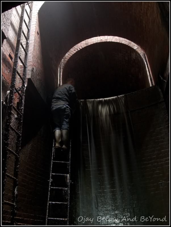
Around 50m upstream of said manhole shaft was a small tumbling bay, the flow of water was no longer present so we assumed it came from upstream ?
Not wanting to hang about I grabbed a quick pic and we bailed..

As I looked up into the spillway above I instantly recognised where we were.
Quickly packing up, having heard the racket previously from the Fleet Mainline was a concern.
Of course we were now eager to solve the phenomenon that had caught others out too, but not tonite!
Here is the overflow looking back down from the Fleet Mainline.

4 Large apertures allow any spill flows when at capacity to be diverted to the Storm Relief below..


Some 8 months later TheVicar and I decided to head back and check out the downstream stretch.
However the mystery of the intermittent discharge got the better of us and needed putting to bed.
In the end it turned out to be a 400m side pipe which lets rip approx every 15-20 mins.
Beyond which appeared to be some kind of holding tank with a deep looking pit below, there was also a glimpse of a ladder..
I'm still not sure what the deal was with this setup and probably never will.
The real annoyance being that this was the only point the GoPro wasn't recording, so sadly no pics :(
We did however head up the tumbling bay and beyond, for a good distance before turning back.
Having looked at the main drainage map, it appears to be a stretch of overflow which serves a branch of the Fleet heading up Caledonia Rd.

On the final trip, I headed downstream with TheVicar to fill in a few more gaps from a previous outing..

The last stretch passes below Farringdon, close to New Fetter Lane, before heading down towards Blackfriars.

Further down the regular trickle from the rising water table which runs through the system is carried away.
It eventually exits via a small tumbling bay, and around the corner to the Low Level No.2 Interceptor below.

Beyond the dam board, is the final stretch towards the Thames.
*Note the tidal fudge;
Even though this is a couple of hundred metres upstream, it backfills from the Thames at high tide!

Further down you can see the water springing through the wall of the Storm Relief.

Beyond this, 2 apertures on the L.H.S heading downstream allow spill flows from the Fleet Mainline near to the Interceptor.

2 x 6ft brick pipes lead to a small overflow chamber, where two valves are used to divert the flow.

Ahead, a ladder leads up to the surface and also a walkway which curves round and ends with an iron wall.

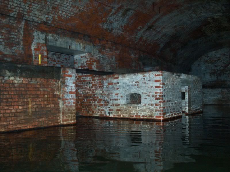
Further down the relief widens to a good 10ft as the pipe splits and heads towards the Outfall Chamber.

Looking back upstream..

Both splits are identical and stop short of 2 reasonable sized valves (flaps).

These are located the other side in an intermediate overflow chamber that serves the Fleet Storm Relief, before entering the main Outfall Chamber..

And finally the Outfall Chamber below Blackfriars, which deals with flows from the storm relief and the Fleet Mainline and Low Level No.2 when at capacity.

Not forgetting the entire downstream section is tidal, and backfills a good distance,
the tide was indeed turning, time to pack up and bail.
Thanks for looking :)








0 comments:
Post a Comment
Note: only a member of this blog may post a comment.